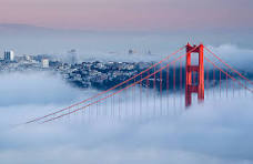
January 5, 1933 was the day the Golden Gate Bridge stopped being an argument and became a set of numbers, tolerances, stresses, and human limits. It was the day the bridge entered the physical world—where ideas are tested not by opinion, but by wind, gravity, and steel stretched to its breaking point.
This is what made that decision extraordinary: nothing at this scale had ever been built under conditions like these.
Before January 5: a problem defined by physics
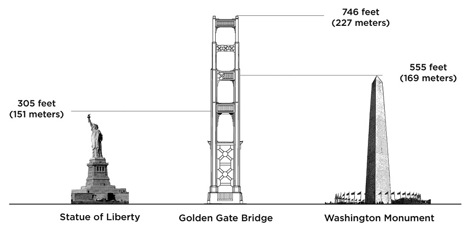
The Golden Gate strait is not merely wide; it is hostile. The main span would need to cross 4,200 feet of open water—longer than any suspension bridge span in the world at the time. The water below reached depths of over 300 feet, with tidal currents exceeding 7 knots. Winds routinely pushed 50–60 mph through the narrow opening. Add fog, salt corrosion, and an active earthquake zone, and the engineering margins grew thin fast.
Critics were not being timid. They were doing the math.
The decision to build anyway
The project moved forward under the leadership of Joseph Strauss, supported by local governments and financed—barely—when Amadeo Giannini personally backed the bonds. The theoretical backbone of the structure came from calculations performed largely by Charles Alton Ellis, whose work translated vision into equations that said, yes, this can stand.
On January 5, those equations met the bay.
Foundations: anchoring the impossible
The first technical challenge was not the span—it was the towers.
Each tower would rise 746 feet above the water, taller than most buildings of the era. To support them, crews sank massive foundations into bedrock far below the surface. This required working from floating platforms, battling currents that could push equipment sideways and make precise placement nearly impossible.
The south tower’s foundation alone weighed over 60,000 tons once complete.
Towers first, cables later
Construction followed a strict sequence:
Foundations and piers
Steel towers
Main suspension cables
Vertical suspender ropes
Roadway deck
The towers were built section by section, steel plates riveted together in midair. Workers balanced on beams sometimes no wider than a boot sole, aligning steel to tolerances measured in fractions of an inch—because errors multiplied dramatically across a mile-long span.
The cables: strength measured in thousands of miles
The bridge’s two main cables remain its most astonishing technical feat.
Each cable:
Measures 36⅜ inches in diameter
Contains 27,572 individual steel wires
Each wire is 0.192 inches thick
Total wire length per cable: ~80,000 miles
Combined wire length: enough to wrap around the Earth more than three times
The wires were not prefabricated. They were spun in place using a moving wheel that carried each wire back and forth across the span, one at a time. Cable spinning took six months, with workers exposed to wind, fog, and vertigo at all hours.
Each cable supports a load of roughly 25,000 tons.
Tension, strain, and living steel
Steel under tension behaves differently than steel at rest. Engineers calculated:
Dead load (weight of the bridge itself)
Live load (traffic, pedestrians, wind)
Dynamic wind loading
Seismic forces
At full load, the bridge can sway up to 27 feet laterally. This is not a flaw. It is survival. Rigidity would have meant failure.
The bridge is designed to move, not resist movement.
Safety engineered into the process
Strauss insisted on safety innovations unheard of at the time:
Mandatory hard hats
Lifelines and handrails
On-site medical staff
And the massive safety net beneath the deck
The net saved 19 men—the “Halfway-to-Hell Club.” Eleven still died, ten in a single accident when a scaffold tore through the net. Even so, the fatality rate was far lower than comparable projects of the era.
Safety, for once, was treated as a technical requirement—not an afterthought.
The roadway: hanging a city street in the air
The deck was assembled in prefabricated sections and lifted into place by cranes mounted on the cables themselves. Once attached, vertical suspender ropes transferred load from deck to cable, distributing weight evenly.
Final dimensions:
Total length: 8,981 feet
Main span: 4,200 feet
Width: 90 feet
Clearance above water: 220 feet
Every number mattered. Change one, and the system changed everywhere.
After January 5: proof through survival
When the bridge opened in 1937, it immediately carried traffic loads no one fully anticipated. It later survived:
The 1957 Fort Point earthquake
The 1989 Loma Prieta earthquake
Constant wind cycles for nearly a century
Its survival validated not only the structure, but the philosophy behind it: design for movement, design for uncertainty, design for people.
What January 5 ultimately celebrates
January 5 is not a date about ribbon-cutting. It is about committing to numbers you cannot yet test and trusting human skill to meet them.
It honors the moment when:
theory met tide,
equations met wind,
safety met necessity,
and steel was asked to behave like a living thing.
The Golden Gate Bridge did not begin as poetry. It began as calculations, rivets, wire under strain, and men willing to trust both.
That trust—measured in miles, tons, inches, and lives—is what January 5 truly marks.
Every year, at the stroke of midnight, millions of people pause—some in crowded city squares, some in living rooms, some alone. Fireworks erupt, glasses clink, and clocks roll forward. It feels celebratory, but beneath the noise lies something far older and quieter: a human instinct to stop time long enough to ask where we’ve been and whether it is safe to go on.
New Year’s Eve is not merely a party. It is one of humanity’s oldest rituals, reshaped again and again as civilizations learned to measure time, fear uncertainty, and hope for renewal.
From Chaos to Order: Why the Year Needed an Ending
The earliest New Year observances were not festive. They were protective.
Thousands of years ago, agricultural societies understood that survival depended on cycles they could not control. The Babylonians marked the new year with Akitu, a multi-day rite meant to reaffirm cosmic order, humility before the gods, and continuity of leadership. The “new year” was not a reset—it was a plea.
Ancient Rome refined this idea when Julius Caesar reformed the calendar in 46 BC. By fixing January 1 as the start of the year, Rome anchored time itself to Janus, the god who looked backward and forward at once. Romans exchanged gifts, offered sacrifices, and spoke carefully, believing the first words of the year could shape the months ahead.
From the beginning, New Year’s Eve was about thresholds—dangerous, hopeful moments when one thing ended and another had not yet begun.
Faith, Restraint, and the Moral Turn
As Christianity spread across Europe, exuberant pagan festivals fell under suspicion. The Church redirected the year’s turning toward reflection rather than revelry. For centuries, the end of the year was marked not with fireworks but with prayers, vigils, and confession.
This tradition never fully disappeared. “Watch Night” services—especially prominent in Methodist and African-American churches—framed New Year’s Eve as a sacred accounting: gratitude for survival, repentance for failures, and trust for what lay ahead.
The message was simple but demanding: celebration without reflection is shallow; reflection without hope is unbearable.
Fire, Noise, and Folk Wisdom
Outside formal religion, people preserved older instincts in folk traditions.
In Scotland’s Hogmanay, torchlight processions and fire festivals symbolized purification. In many cultures, loud noises were believed to chase away misfortune—an echo of ancient fears that the boundary between years left communities vulnerable.
What we now call “festive chaos” once served a serious purpose: protecting the future by confronting the unknown.
The Clock Takes Over: Modern New Year’s Eve Is Born
The Industrial Revolution changed everything. Once time became standardized—regulated by clocks, railways, and broadcast signals—midnight itself became the star.
In 1907, a glowing sphere descended in Times Square, creating a ritual that transformed New Year’s Eve into a shared national moment. Later, television turned it global. Fireworks over Sydney now greet the year before much of the world is awake, passing the celebration westward like a torch.
New Year’s Eve became less about survival and more about synchronization—humanity counting together.
Noteworthy Stories That Shaped the Meaning
1. Vows Older Than Resolutions
Modern New Year’s resolutions often feel flimsy, but their roots are ancient. Babylonians made promises to repay debts and return borrowed tools. Romans vowed loyalty and moral improvement. What changed is not the impulse, but our patience.
The failure of resolutions is not proof of their foolishness—it is evidence that self-examination has always been hard.
2. Midnight in Wartime
One of the most poignant New Year stories comes not from a party, but from silence.
During World War I, soldiers wrote letters describing New Year’s Eve in the trenches—cold, dark, uncertain. In some places, guns fell quiet at midnight. Men on opposite sides marked the passing year with prayers rather than gunfire, unsure if they would see another.
The calendar turned, but the war did not end. The moment mattered anyway.
3. The Baby New Year
The image of a diaper-clad infant replacing an old man with a beard emerged in 19th-century America. It is sentimental, but revealing. The symbol suggests not erasure of the past, but inheritance: the old year hands something unfinished to the new.
The baby does not judge the year that was. It simply receives it.
Why We Still Gather
Despite centuries of change, New Year’s Eve retains its core tension:
We celebrate because survival deserves joy.
We reflect because denial is dangerous.
We hope because despair is unsustainable.
Fireworks today are not so different from ancient fires. They declare, in light and sound, that we are still here.
The Deeper Meaning of Midnight
New Year’s Eve is not about pretending the past did not happen. It is about acknowledging that time moved forward anyway.
At midnight, we stand in a narrow space where memory and possibility overlap. We look back—not to relive—but to understand. We look forward—not to predict—but to commit.
That is why the ritual endures.
Conclusion: The Year Ends Whether We Pay Attention or Not
The calendar will turn without our consent. What remains a choice is whether we notice.
Across civilizations, faiths, wars, and technologies, New Year’s Eve has survived because it answers a human need deeper than celebration:
To pause long enough to tell the truth—then step forward anyway.
Fireworks fade. Music ends. Glasses are set down. But the quiet question lingers into the first morning of the year:
Given what we now know, how shall we live the days we’ve been given next?
That question—asked honestly—is the oldest New Year’s tradition of all.
The Handoff
Midnight is not an ending so much as a transfer.
One year does not disappear when the clock strikes twelve; it places its weight gently—but firmly—into the hands of the next. What we learned does not evaporate. What we failed to do does not reset. What endured does not need to be announced again.
New Year’s Eve marks the moment when time pauses just long enough to look both ways. But the work of living has never belonged to midnight. It belongs to the hours that follow—when the noise fades, when the lights dim, and when responsibility returns without ceremony.
The celebration marks the handoff. The morning receives it.
And so, having stood at midnight and named what this turning means, it is right to ask what comes next—not with promises shouted into the dark, but with attention offered quietly in the light of a new day.
Skills, Motivation, and the Capabilities Behind Accurate Mapping
Introduction: The Human Attempt to Shrink the World Into Understanding
A map seems simple at first glance: a flat surface covered with lines, shapes, labels, and colors. Yet the act of creating an accurate map is one of the most difficult intellectual tasks humans have ever attempted. Mapping demands a rare combination of observation, mathematics, engineering, imagination, artistry, philosophy, and courage. It requires a person to look at a world too large to see all at once and to represent it faithfully on something small enough to hold in the hand. Every map, whether carved on a clay tablet or drawn by satellite algorithms, is a claim about what is real and what matters.
This paper explores the mapmaker’s mind across four eras—ancient, exploratory, philosophical, and modern technological—and then strengthens that understanding through case studies and technical appendices. Throughout the narrative, one idea remains constant: accuracy is not merely a technical achievement; it is a human triumph grounded in the mapmaker’s inner capabilities.
I. Ancient Mapmakers: Building Accuracy from Memory, Observation, and Survival
For thousands of years, before the invention of compasses, sextants, or even numerals as we know them, mapmakers relied on the most fundamental tools available to any human being: their memory, their senses, and their endurance.
A Babylonian cartographer might spend long days walking field boundaries and tying lengths of rope to stakes to re-establish property lines after floods. An Egyptian “rope stretcher” could look at the shadow of a pillar, note the angle, and derive a surprisingly accurate sense of latitude and season. Polynesian navigators sensed the shape of islands from the swell of the ocean, the direction of prevailing winds, the pattern of clouds, or the flight paths of birds—even when land was hundreds of miles away. All of this happened without written language in many places, and without anything like formal mathematics.
The motivations were simple but powerful. Survival required knowing where water, game, shelter, and danger lay. Governance required knowing how much farmland belonged to whom, where the temples held jurisdiction, and how to tax agricultural output. Trade required predictable knowledge of paths, distances, and safe passages. Human curiosity played its own role as well; people have always wanted to know the shape of their world.
Accuracy in ancient mapping was limited by natural constraints. Long distances could not be measured with confidence. Longitude remained elusive for nearly all of human history. Oral traditions, though rich, introduced distortions. Political agendas often shaped borders. And yet ancient maps show remarkable competence: logical river systems, consistent directions, recognizable landforms, and surprisingly stable proportionality. Accuracy was relative to the tools available, but the intent—the desire to record reality—was the same as today.
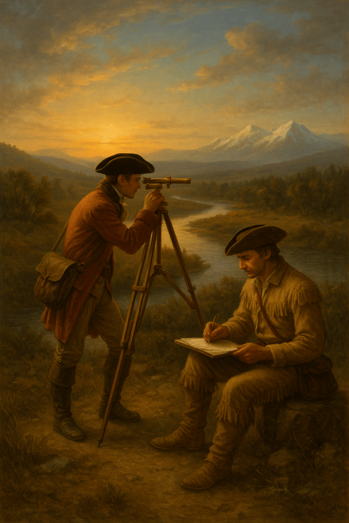
II. Explorers and Enlightenment Surveyors: Lewis & Clark and the Birth of Scientific Mapping
The early nineteenth century introduced a new kind of cartographer: the trained surveyor who combined field observation with scientific measurement. Lewis and Clark exemplify this transition.
Armed with sextants, compasses, chronometers, astronomical tables, and notebooks filled with surveying instructions, they attempted to impose geometric precision on a landscape no European-American had ever mapped. They measured solar angles to determine latitude, recorded compass bearings at virtually every bend of the Missouri River, estimated distances by managing travel speeds, and triangulated mountain peaks whenever weather permitted. Their notebooks reveal how meticulously they checked, recalculated, and corrected their own readings.
Their motivation blended national ambition, Enlightenment science, personal curiosity, and a desire for legacy. President Jefferson viewed the expedition as a grand experiment in empirical observation and hoped to gather geographic, botanical, zoological, and ethnographic knowledge all at once. Lewis and Clark themselves were deeply committed to documenting not only what they saw but how they measured it.
Despite their tools, they faced severe limitations. Cloud cover often prevented celestial readings. Magnetic variation made some compass bearings unreliable. River distances were difficult to estimate accurately when paddling against currents. Longitudes were usually approximations, sometimes guessed, because no portable timekeeping device of the period could maintain accuracy under field conditions. Yet the map produced from their expedition defined the American West for decades, confirmed mountain ranges, captured river systems, located tribal lands, and fundamentally reshaped the geographic understanding of a continent.
Their accomplishment demonstrates that accuracy is a function not only of tools but of discipline, repetition, cross-checking, and the mental fortitude to tolerate error until it can be corrected.
III. The Philosophical Mapmaker: Understanding That a Map Is a Model, Not the World
One of the most difficult but essential truths in cartography is that a map can never be fully accurate in every dimension. A map is a model, not the thing itself. Understanding this transforms how we judge accuracy.
No map can include everything. The mapmaker must decide what to include and what to omit, what to emphasize and what to generalize. This selective process shapes meaning as much as measurement does. A map that focuses on roads sacrifices terrain; a map that shows landforms hides political boundaries; a nautical chart prioritizes depth, hazards, and tides while ignoring nearly everything inland.
Even more fundamentally, the Earth is round and a map is flat. Flattening a sphere introduces distortions in shape, area, distance, or direction. No projection solves all problems at once. The Mercator projection preserves direction for navigation but distorts the sizes of continents dramatically. Equal-area projections preserve proportional land area but contort shapes. Conic projections work beautifully for mid-latitude regions like the United States but fail near the equator and poles.
Scale introduces another layer of philosophical choice. A map of a neighborhood can show driveways, footpaths, and fire hydrants; a map of a nation must erase tens of thousands of such details. At global scale, even major rivers become thin suggestions rather than features.
Finally, maps inevitably carry bias. National borders are often political statements as much as geographic descriptions. Cultural assumptions guide what is considered important. The purpose of a map—a subway map, a floodplain map, a highway atlas—governs its priorities. Every map quietly expresses a worldview.
Thus, “accurate” does not mean “perfectly true.” It means “fit for the purpose.” A map is correct to the extent that it serves the need it was created for.
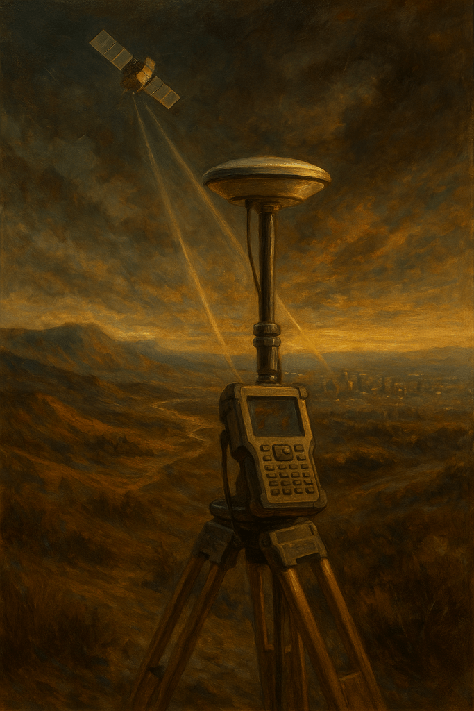
IV. The Modern Cartographer: Satellites, GIS, and the Era of Precision
The modern mapmaker operates in a world overflowing with spatial information. GPS satellites circle the earth, constantly broadcasting timing signals that allow any handheld receiver to determine position within a few meters—and survey-grade receivers to reach centimeter-level accuracy. High-resolution satellite imagery captures coastlines, forests, highways, and rooftops with astonishing clarity. LiDAR sensors measure elevation by firing millions of laser pulses per second, creating three-dimensional models of terrain. GIS (Geographic Information Systems) software organizes, analyzes, and visualizes enormous spatial datasets.
The work of the modern cartographer is less about drawing lines and more about managing data. A GIS analyst must understand spatial statistics, database schemas, metadata verification, remote sensing interpretation, coordinate transformations, and the difference between nominal, ordinal, interval, and ratio data. The skill set is analytical, computational, and scientific.
The motivations have expanded as well. Modern mapping supports transportation engineering, zoning, emergency response, flood mitigation, environmental policy, epidemiology, commercial logistics, climate science, and international security. Governments, companies, and researchers all rely on constantly updated maps to make daily decisions.
Yet the abundance of data introduces new complications. Errors no longer stem primarily from lack of information but from inconsistency among datasets, outdated imagery, automated misclassification, incorrect coordinate transformation, or the false sense of precision that digital numbers can give. Even in a world of satellites, the mapmaker must remain vigilant and skeptical. Accuracy must still be earned, not assumed.
V. Case Studies: How Real Maps Achieve Real Accuracy
The theory of mapmaking becomes clearer when examined through specific examples. Four case studies reveal how different contexts produce different solutions to the same universal problem.
Case Study 1: The USGS Topographic Map
The United States Geological Survey began producing standardized topographic maps in the late nineteenth century, combining triangulation, plane-table surveying, and field verification. Later editions incorporated aerial photography and eventually satellite data. These maps formed the spatial backbone of national development. Engineers relied on them to place highways, dams, airports, pipelines, and railroads. Hikers and outdoor enthusiasts still use them today.
Their accuracy was remarkable for their time: often within a few meters horizontally and within a meter vertically. They became the nation’s common spatial language, demonstrating how consistent methodology and repeated verification create reliability across vast geographic space.
Case Study 2: Nautical Charts and the Challenge of the Ocean
No mapping discipline demands more caution than nautical charting. Mariners depend on accurate depths, hazard markings, and tidal information. Early sailors used weighted ropes and visual triangulation to estimate depth. Today’s hydrographers use multibeam sonar, satellite altimetry, LiDAR bathymetry, and tide-corrected measurements to produce charts that can reveal underwater features with astonishing detail.
Yet the ocean floor is dynamic. Storms move sandbars. Currents reshape channels. Dredging alters harbor depths. For this reason, nautical charts are never fully “finished.” They require constant updating. The challenge is not simply measuring depth once, but sustaining accuracy in a world that changes.
Case Study 3: The London Underground Map and the Meaning of “Accuracy”
The London Tube Map, introduced by Harry Beck in 1933, revolutionized the concept of cartographic truth. Beck realized that subway riders did not need geographic precision. They needed simplicity, clarity, and relational accuracy—knowing how stations connected, not how far apart they were in miles.
By replacing geographic realism with abstract geometry, he created a map that was technically inaccurate but functionally brilliant. Nearly all subway maps worldwide now follow the same principle. This case study illustrates that the “right” map is the map that serves the user’s need, not the map that most faithfully represents ground truth.
Case Study 4: Google Maps and the Algorithmic Cartographer
Google Maps represents an entirely new form of mapping. Unlike paper maps, it is not a static depiction of geography. It is a constantly shifting model created from satellite images, aerial photos, street-level observations, user reports, and complex routing algorithms. It recalculates itself continuously, adjusting for traffic, construction, business changes, and political variations in border representation.
Its power is extraordinary, but its limitations remind us that automation cannot eliminate human judgment. The platform reflects commercial incentives, political boundaries, and the imperfections of crowdsourced information. Accuracy is high but uneven, and like the ocean charts, the system must be updated constantly to remain trustworthy.
VI. A Unified Theory of Mapmaking
Across all eras and technologies, the mapmaker’s challenge remains the same. The world is too large and too complex to be perceived directly, so the mapmaker must choose which aspects of reality to capture. Those choices—shaped by purpose, tools, knowledge, and bias—determine whether the resulting map will be useful or misleading. Measurement introduces error; projection introduces distortion; interpretation introduces judgment. Accuracy is always relative to context, intention, and method.
The mapmaker succeeds not by eliminating error altogether, but by understanding its sources, managing its influence, and balancing the competing truths that every map must negotiate.
VII. Technical Appendices
Appendix A: Coordinate Systems and Projections
Modern mapping rests on systems that allow the entire Earth to be described mathematically. Latitude and longitude divide the globe into degrees, providing a universal reference easy to conceptualize but difficult to measure perfectly at large scales. The Universal Transverse Mercator (UTM) system divides the Earth into narrow vertical zones, each of which minimizes distortion for engineering purposes. The North American Datum (NAD83) and the World Geodetic System (WGS84) provide precise mathematical models of the Earth’s shape, enabling GPS receivers to calculate location with remarkable accuracy.
Map projections translate the curved surface of the Earth to a flat plane. Each projection sacrifices something: the Mercator preserves direction but exaggerates the size of high-latitude regions; equal-area projections maintain proportional land area at the cost of distorting continents; the Robinson projection compromises carefully to create a visually balanced world. The choice of projection reflects the map’s purpose more than the mapmaker’s preference.
Appendix B: Surveying Instruments Through Time
The tools of mapping have evolved dramatically. Ancient civilizations used gnomons to measure shadows, ropes to mark distances, and rudimentary cross-staffs to gauge angles. Renaissance innovations introduced compasses, astrolabes, sextants, and the plane table, bringing scientific precision to exploration. By the eighteenth century, the theodolite allowed surveyors to measure angles with unprecedented accuracy.
Modern surveyors rely on total stations, which combine angle measurement with laser-based distance calculation; GNSS receivers capable of centimeter-level precision; LiDAR instruments that generate three-dimensional point clouds of terrain; and drones that capture aerial photographs suitable for photogrammetric reconstruction. Although the instruments have changed, the underlying goal has remained constant: to measure the Earth in a way that minimizes error and maximizes reliability.
Appendix C: Sources of Error and How Mapmakers Correct Them
Cartographic errors emerge from several sources. Positional error occurs when instrument readings or GPS signals are distorted by environmental conditions, equipment limitations, or signal reflections from buildings or terrain. Projection error arises because any flat map must distort some combination of shape, area, direction, or distance. Human interpretation error appears during the classification of aerial images or the delineation of ambiguous features. Temporal error affects maps that have not been updated to reflect natural or man-made changes.
Mapmakers mitigate these errors by using redundant measurements, cross-checking data from multiple sources, incorporating ground-truth verification, applying statistical corrections, and selecting projections tailored to the region being mapped. Accuracy is achieved not through perfection but through a disciplined process of detecting, bounding, and correcting inevitable imperfections.
Conclusion: The Eternal Mind Behind the Map
From a Babylonian surveyor tying knots in a rope, to a Polynesian navigator reading waves in the dark, to Lewis and Clark marking compass bearings along unknown rivers, to a modern GIS analyst adjusting satellite layers on a computer screen, the mapmaker’s mind has never changed in its essential character. The world is too vast, varied, and dynamic to be seen directly, so we create representations—models that reveal structure, meaning, and relationship.
A map is not merely a depiction of space. It is a human judgment about what matters. Every accurate map represents a triumph of curiosity over ignorance, order over chaos, and understanding over confusion. The tools are part of the story, but the deeper story is the capability of the person wielding them: the patience to measure carefully, the discipline to verify and correct, the imagination to translate complexity into clarity, and the humility to know that no map is final, complete, or perfect.
Mapmaking is the oldest form of reasoning about the world, and perhaps the most enduring. To draw a map is to make the world legible. To understand a map is to understand the choices of the person who created it. And to appreciate accuracy is to recognize that behind every line lies a mind trying to grasp the infinite.
When I was young, about 10, as I remember, a family on our street in Farmers Branch invited me to go to Galveston. There was no real highway like I-35 now, so we traveled down narrow Highway 75. No dividers between lanes. I remember that it was dark. I was sitting in the middle of the back seat with three of the family kids, leaning forward watching the bright headlights coming the opposite direction.
I think the crash happened in Center, Texas. All of a sudden, the movie froze like a broken reel in a theater. We had been hit by a car passing another car in our lane. I remember being stunned, getting out of the vehicle, and stumbling a few feet as I tried to make sense of what had just happened. Before long, emergency vehicles were everywhere. A man in the other car in the head-on collision was thrown through the windshield and was dead. The neighbor driving the car I was in was seriously injured when impelled by the steering wheel column.
The next thing I remember is that the mother went with the first responders to the hospital to be with her husband. All of us kids were taken to the home of someone in the community. I can’t remember if we stayed there one night or two. And I don’t know how we got back home to Farmer’s Branch.
What I do remember with perfect clarity is waking up to church bells on Sunday morning. If there were any churches with bells in Farmers Branch, they were too far off for me to hear. This was the first time I heard the wooing of the church bells. Soothing. Friendly. Assuring that everything was going to be okay. LFM
History, Meaning, and the Music of Bells
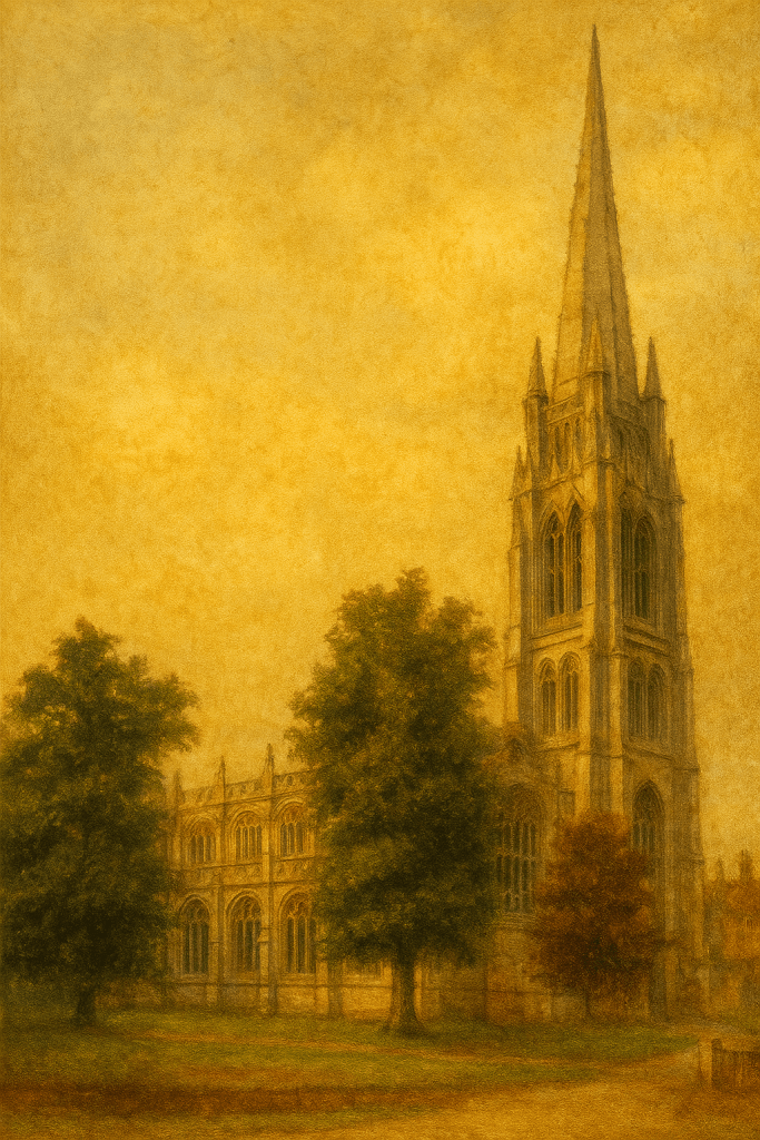
When you approach a village and see, beyond the trees and rooftops, a slender spire breaking the horizon, you are witnessing more than architecture. The church steeple is the meeting place of heaven and earth — a human hand raised upward, a prayer in timber and stone.
Long before skyscrapers and radio towers, the steeple was the tallest thing people knew. It marked the center of the community, both geographically and spiritually. From its belfry rang the sounds of life itself — wedding chimes, funeral tolls, and the daily hours that once kept an entire village in rhythm.
To hear the bells was to belong. Their sounds crossed class lines, carried through fog and rain, and reminded each listener that they were part of something enduring. In the stillness of dawn or the hush of dusk, a steeple’s toll was not just a summons to worship, but an assurance that civilization itself still stood watch.
The sight of a steeple from afar was equally moving. For travelers, it meant arrival — a promise of rest, bread, and fellowship. For locals, it was the vertical symbol of continuity: seasons may turn, but the church still stands, calling hearts homeward.
Through centuries of design — Romanesque solidity, Gothic aspiration, and Colonial simplicity — the steeple has remained both beacon and anchor. Its height draws the eyes upward; its bells draw the soul inward. Together they create that rare harmony of architecture and faith where the material world becomes a metaphor for eternity.
The Steeple’s Song
From the tower’s view above the town
I’ve watched your rooftops silvered dawn, Your children laughing on the lawn, Your lovers walking as shadows fall, And I have tolled the hour for all.
I’ve seen your seasons, year by year — Spring’s first bloom and winter’s tear; I’ve counted time in steady chime, And kept your faith when you lost mine.
From up where swallows weave their flight, I greet the day, I guard the night. When thunder rolls and sirens cry, My bells still sing to calm the sky.
I’ve heard your vows beneath my spire, Your whispered prayers, your heart’s desire. I’ve marked the birth, the ring, the rest — Your cradle, union, final guest.
I’ve seen the fields turn gold, then gray, The mills grow still, the children stray; Yet still I stand, though years may dim, A bridge between your world and Him.
For every soul that passes by, I lift my gaze to where hopes lie. My cross still gleams through storm and blue — A finger pointing Godward, true.
So when my bells across the vale Send echoes soft through hill and dale, Know this: I ring not just for prayer, But to remind you — Love is there.
Reflection
Every town needs a church with a steeple — not merely as a relic, but as a reminder. It is the one structure that insists on looking up.
In its shadow, generations have laughed, wept, married, and buried. Its bells do not ask for perfection; they call for presence. They tell us that civilization, at its best, is not measured by wealth or power, but by how faithfully we lift our eyes and our hearts beyond ourselves.
Three Famous Steeples of the World
St. James’ Church, Louth (England)
Built: 15th–16th centuries Height: 287 ft
A Gothic marvel rising from a modest market town, it is known for its elegant pinnacles and sheer verticality — evoking both awe and aspiration in the quiet Lincolnshire countryside. Its daring height symbolizes the upward reach of faith within ordinary life, where everyday worshippers once built a tower that nearly touches the clouds.
Temple Saint-Étienne, Mulhouse (France)
Built: 1859–1866 Height: 318 ft
An Alsatian landmark often called the “Cathedral of the Reformed Faith,” it stands as a Protestant interpretation of Gothic grandeur. Its rose windows and tracery recall medieval cathedrals, yet the spirit within it is one of clarity and simplicity — grandeur made humble, devotion expressed in light and stone.
St. Patrick’s Cathedral, New York City (USA)
Built: 1858–1878 Twin Spires: 330 ft
A marble monument to faith amid steel skyscrapers, it was completed when Midtown Manhattan was still young. Its soaring spires now rise among towers of commerce and glass, reminding the modern city that heaven’s reach and human ambition can coexist — that even in the noise of New York, the bells still call souls home.
A collaboration between Lewis McLain & AI (more from the three visits Linda & I had to the Louvre with high school students from Trinity Christian Academy).
Antonio Canova and the Awakening of the Soul
Introduction
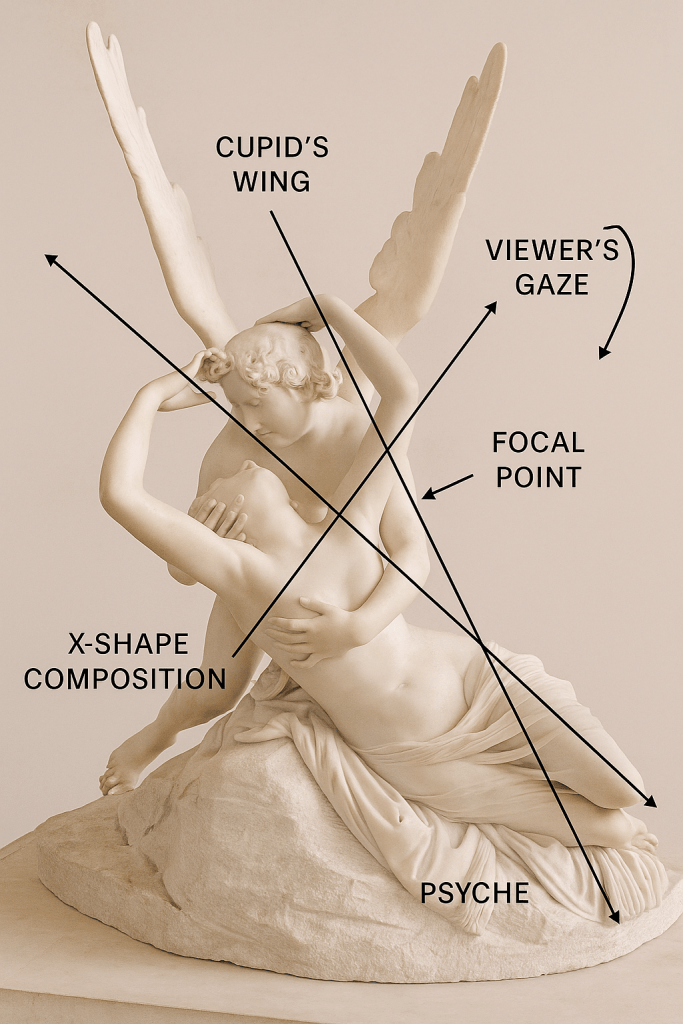
Among the marble treasures of the Louvre Museum stands one of the most moving sculptures of all time — Psyche Revived by Cupid’s Kiss, carved by the Italian master Antonio Canova between 1787 and 1793. It depicts the mythological moment when the god Cupid (Eros) revives his beloved Psyche with a kiss, restoring her from deathlike sleep to life and love.
At once tender, idealized, and technically perfect, this masterpiece captures not only the beauty of myth but also the intellectual spirit of the Neoclassical age. For any student observer, it represents the perfect synthesis of form, feeling, and philosophy — a lesson in how art can make marble breathe.
1. The Artist and His Era
Antonio Canova (1757–1822) was born in Possagno, Italy, into a family of stonemasons. Trained in Venice and working in Rome, he became the undisputed master of the Neoclassical style, the artistic movement that sought to revive the order, harmony, and moral clarity of ancient Greece and Rome.
Canova’s art emerged during the Age of Enlightenment, a time when reason, science, and rediscovered antiquity guided intellectual life. Artists looked to classical sculpture for purity of line and noble simplicity. Against the emotional extravagance of the Baroque, Canova’s figures embodied balance, restraint, and serenity.
His goal, he once said, was to give marble the “appearance of living flesh” — and through meticulous polishing and proportion, he succeeded. His works, such as Perseus with the Head of Medusa and The Three Graces, stand as paragons of refinement and calm emotional depth.
2. The Myth of Cupid and Psyche
The story comes from Apuleius’s The Golden Ass (2nd century A.D.), one of the most enduring love myths of classical antiquity.
Psyche, a mortal woman of exceptional beauty, arouses the jealousy of Venus (Aphrodite), who orders her son Cupid to make Psyche fall in love with a monster.
Instead, Cupid himself falls in love with Psyche, visiting her each night unseen. When Psyche disobeys his order never to look at him, he vanishes.
After many trials set by Venus, Psyche opens a box meant to contain beauty but instead releases a deadly sleep upon herself.
Cupid finds her lifeless body, lifts her in his arms, and awakens her with a kiss.
In the end, the gods grant Psyche immortality so she may be eternally united with Cupid.
The myth is a timeless allegory of the soul’s (psyche) awakening to divine love and eternal life — a theme that resonated deeply with both ancient philosophy and Christian symbolism.
3. Commission and Creation
Canova received the commission around 1787 from Colonel John Campbell, a British nobleman visiting Rome. The sculptor completed the work by 1793, using Carrara marble, prized for its pure white translucence.
He later produced a second version (1796), now in the Hermitage Museum, but the first — the Louvre version — remains the most celebrated. It was acquired by Joachim Murat, Napoleon’s brother-in-law, and entered the Louvre’s collection in 1824.
Canova personally oversaw every stage of its creation, using fine abrasives and oil to achieve an extraordinary surface polish. This allowed light to glide across the marble as if over living skin, enhancing the illusion of breath and movement.
4. Composition and Form
The sculpture captures the precise instant of awakening: Cupid bends over Psyche, supporting her head with one hand while their lips draw near. Psyche’s arms reach upward to encircle him, creating a perfect X-shaped composition — a dynamic cross of limbs and wings that binds the figures together.
Key features to observe:
Cupid’s wings rise upward like an angelic halo, framing the scene and drawing the eye toward the couple’s faces.
Psyche’s body arches in a graceful curve, suggesting both fragility and renewal.
Their hands and faces form the emotional focal point — the intersection of life, love, and divine energy.
The base of the sculpture, rough and unpolished, contrasts with the smooth flesh above, symbolizing the transition from earthly death to heavenly awakening.
In the educational diagram below, the X-shape composition and the diagonal lines of sight show how Canova directs the viewer’s gaze from Cupid’s wings to Psyche’s face and then downward through the drapery — a continuous flow of motion through stillness.
5. Symbolism and Interpretation
Canova’s sculpture is far more than an illustration of a myth — it is a philosophical meditation on love and the soul.
The moment of Psyche’s awakening becomes a symbol of spiritual rebirth. The butterfly, often associated with Psyche in classical art, represents transformation — the soul leaving its cocoon of mortality. Cupid, as divine love, breathes eternal life into that soul.
The composition’s diagonal tension embodies both physical energy and emotional ascent: the human yearning for the divine, the eternal dance between matter and spirit.
In Neoclassical thought, beauty was a moral force — the visible expression of virtue and truth. Thus, Canova’s restrained tenderness contrasts with the passionate turmoil of Baroque art. Love here is not sensual conquest but spiritual restoration.
6. Reception and Legacy
When first exhibited in Rome, Psyche Revived by Cupid’s Kiss was immediately recognized as a masterpiece. Critics called it “the triumph of grace over passion.” Visitors were captivated by its lifelike delicacy and emotional power conveyed without exaggeration.
It became a defining work of Neoclassicism, illustrating how calm form could evoke profound feeling. The sculpture influenced generations of artists — including Bertel Thorvaldsen, Jean-Baptiste Carpeaux, and later Romantic painters who explored the harmony of body and spirit.
Even into the 19th century, it remained a reference point for art academies, where students studied its anatomy, symmetry, and emotion as an ideal of beauty.
7. Observing the Sculpture in the Louvre
The sculpture is displayed in the Denon Wing, Room 403, near Michelangelo’s Dying Slave and Rebellious Slave. The museum’s lighting enhances the subtle contrast between shadow and shine that Canova intended.
For a student observer:
Move around the sculpture; every angle reveals a new emotional dialogue.
Notice how light travels across the marble — the figures almost seem to breathe.
Observe how Cupid’s downward gaze meets Psyche’s upward movement, forming an eternal loop of love and revival.
Pay attention to the texture contrast between the finely polished skin and the rough rock — symbolizing transformation from mortality to divinity.
This active observation turns the experience from passive viewing into an encounter with Canova’s philosophy of life and art.
8. Enduring Meaning for Students
For modern students, Psyche Revived by Cupid’s Kiss offers three timeless lessons:
Technical mastery serves emotional truth. Canova’s polish and proportion allow the emotion to flow through form rather than overwhelm it.
Balance creates beauty. The sculpture’s X-shaped harmony shows how composition guides feeling.
Love awakens the soul. Beyond its mythic story, it reminds us that true beauty unites body and spirit, art and life.
In this sense, Canova’s work is not just about marble or myth — it is about humanity’s eternal desire for renewal, compassion, and transcendence.
Conclusion
In Psyche Revived by Cupid’s Kiss, Antonio Canova transformed stone into spirit. He captured the silent instant where death yields to love, and stillness becomes motion. His art bridges mythology and philosophy, sensuality and serenity, mortal and divine.
For all who stand before it — whether in wonder, study, or reverence — the message remains the same: Love revives, beauty endures, and art can awaken the sleeping soul.
“The beauty of the body is the beauty of the soul made visible.” — Antonio Canova
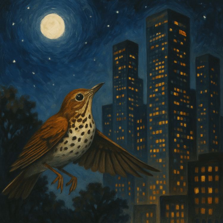
Every year, more than a billion birds migrate across North America, traversing thousands of miles between their breeding and wintering grounds. These journeys are guided by instinct, celestial navigation, magnetic fields—and increasingly disrupted by one major human factor: artificial light at night. The bright glow of modern cities lures birds off course, disorients them, and often leads to fatal collisions with glass buildings.
Cities that turn off or dim nonessential lights during peak migration seasons can prevent hundreds of thousands of bird deaths. Implementing such changes requires more than flipping a switch—it involves understanding bird behavior, adjusting building policies, managing light pollution, and building public awareness.
This guide educates and equips local governments, building owners, designers, students, and the public to understand and address this avoidable ecological crisis.
Part 1: The Science of Migration
Birds migrate to survive. They follow ancient routes each spring (March through June) and fall (August through November), driven by food availability, breeding cycles, and temperature shifts. Most species migrate at night to avoid predators, conserve energy, and navigate by the stars.
However, artificial light confuses their internal compass. Most birds take off within 30 to 60 minutes after sunset. Peak flights typically occur 2 to 4 hours after dusk, with birds flying at elevations of 500 to 2,000 feet. This makes them especially vulnerable to tall, illuminated buildings.
Part 2: How Light and Glass Kill
Birds cannot recognize glass as a barrier. To them, it either reflects what’s behind them or appears invisible. Transparent corners, reflective windows, and brightly lit interiors create the illusion of open sky or shelter.
Birds are drawn toward city lights—particularly during cloudy or moonlit nights. The brighter the building, the more likely it is to attract and disorient migratory species. Fatal collisions spike during migration peaks. One study in Chicago found that turning off lights on a set of downtown buildings reduced bird deaths by over 80% (Ecological Applications, 2009).
Part 3: When and Where Collisions Are Worst
Spring migration (March 15–June 15) and fall migration (August 15–November 15) are the most critical periods. Birds such as the wood thrush, blackpoll warbler, and golden-winged warbler are among the most vulnerable.
Cities on major flyways—like Chicago (Mississippi Flyway), Dallas (Central Flyway), and New York (Atlantic Flyway)—see the highest levels of mortality. On some nights, radar confirms that over 400 million birds are airborne across the U.S. (BirdCast).
Part 4: Current Ordinance Models
Cities have approached the issue in multiple ways:
Voluntary programs such as “Lights Out” (Chicago, Dallas, Houston)
Mandated bird-safe glazing ordinances (New York City, Toronto)
Green building guidelines that include bird protection standards (San Francisco)
Strong laws target buildings 4 stories or taller or those with 40%+ glass on lower façades. Effective programs reduce exterior lighting from 8:00 PM to 2:00 AM and require bird-safe glass in new construction.
Part 5: Sample Model Ordinance Components
Migration Periods: March 15 to June 15 and August 15 to November 15
Covered Buildings: Structures 4+ stories tall or with ≥40% glass within first 60 vertical feet
Lighting Rule: Extinguish/dim nonessential exterior/interior lighting from 8:00 PM to 2:00 AM
Glass Rule: Bird-safe glazing (e.g., fritted, patterned, UV reflective) on new construction or major renovation
Reporting: Building managers must report if 3 or more birds die on their site in one night
Enforcement: Educational warnings escalate to fines and permit reviews
Public Engagement: Outreach campaigns, city-sponsored monitoring, BirdCast alerts
Incentives: Tax abatements, public awards, fast-track permits for compliant projects
Part 6: The Politics and Pushback
Some developers object to the cost of glass retrofits or the aesthetic limitations of fritting. Business associations worry about dimming signage or nighttime visibility.
In several U.S. states, especially those with strong anti-regulatory politics, local ordinances have been challenged or preempted. Nonetheless, cities have found success when they:
Start with voluntary programs
Apply rules to new construction only
Offer phase-in periods for retrofits
Provide clear visuals and alternative compliance paths
Part 7: A Scripted City Council Debate
[Scene: City Council Chambers – Exampleville – Evening Meeting on the Proposed Bird-Safe Lighting Ordinance. The public gallery is nearly full. A large screen behind the dais displays a title slide: “BIRD-SAFE LIGHTING: Proposed Ordinance for Migratory Protection.” The atmosphere is a mix of civic seriousness and simmering tension.]
Councilmember Rodriguez (Environment Committee Chair): “Colleagues, we have before us Ordinance 25-102: requiring certain buildings to dim or extinguish nonessential lighting between 8 PM and 2 AM during migratory seasons, and to incorporate bird-safe glazing in new construction. I want to start by saying: this is not a symbolic ordinance. This is about life and death—measurable, preventable, local deaths of creatures flying thousands of miles. This is stewardship.”
Councilmember Garrett (At-Large): “I appreciate the heart behind this, but I’m also hearing from property owners—especially downtown—that this proposal could cost them significantly. They’ve raised questions about how lighting reductions might affect nighttime safety, tourism visibility, and brand presence. What’s our strategy for mitigating unintended consequences?”
Councilmember Nguyen (District 3): “Let’s clarify: we are not banning lights. We’re asking that buildings dim or turn off nonessential lighting—accent lights, internal lobby glows, façade spotlights—during specific high-risk windows. That’s 8 PM to 2 AM, only from March to June and August to November. Buildings can still meet all safety and egress codes.”
Councilmember Vega (Deputy Mayor Pro Tem): “We also have to acknowledge public health and ecological science. This is backed by Cornell, the National Audubon Society, and hundreds of radar studies. We have collision data from our own downtown—over 1,000 carcasses collected last fall alone by volunteers from Local Audubon. Those are just the ones we found.”
City Planner (staff): “We’ve modeled the cost of retrofitting a mid-rise glass building with fritted or patterned glazing on the first 60 feet. It averages $3.50 to $5 per square foot. For new construction, the cost difference is often under 1%. For lighting, motion sensors and timers are inexpensive and often reduce utility costs.”
Public Comment – Ms. Lily Tran, 5th Grade Science Teacher: “My students are tracking migration using BirdCast and eBird. We identified over 50 species flying above this city just last week. They’re excited—until they hear about the dead birds outside City Hall and the convention center. They asked me, ‘Do the people in charge know? Do they care?’ Please show them we do.”
Public Comment – Mr. Elias Price, Developer Association: “I want to be clear: we support conservation in principle. But requiring bird-safe glass adds costs. Some of our clients are nonprofits and small businesses. They can’t absorb another code layer. Where are the incentives? Why not encourage first, regulate later?”
Public Comment – Ms. Carol Brenner, Private Citizen: “I don’t know when the city decided birds were more important than people. We’re already under pressure from zoning changes, water restrictions, emissions rules—and now you want to tell me what time I can turn my lights on? This is government overreach, plain and simple. I moved here for freedom, not to be micromanaged by a committee that’s never run a small business.”
Councilmember Rodriguez (responding): “Ms. Brenner, I understand the frustration. But let’s be clear—this ordinance doesn’t affect residential homes or mom-and-pop shops. It’s targeted to large commercial buildings with known collision risk. And it’s not just about birds. This reduces energy waste, saves on nighttime utilities, and lowers skyglow that affects human sleep patterns too.”
City Attorney: “The ordinance includes a variance process for hardship exemptions and allows for phased compliance. We also structured the enforcement to start with education and warnings—not immediate fines.”
Councilmember Nguyen: “We’ve done the listening. We’ve held four public forums. We’ve amended the original language to exclude single-story buildings, exempt signage, and clarify compliance options. We’ve built a reasonable, science-based, phased-in policy. And we’re still the second city in the region to even attempt this.”
Councilmember Garrett: “Can we include a provision that city-owned buildings must comply first? Lead by example?”
Councilmember Rodriguez: “Absolutely. That’s in Amendment B. Our libraries, fire stations, and City Hall will retrofit by next spring.”
Mayor: “Seeing no further comments, we move to vote. Ordinance 25-102, as amended, with variances, educational-first enforcement, and municipal leadership provisions. All in favor?”
[Six hands rise. One abstains. Motion carries. Applause from half the gallery.]
Part 8: Tools for Public Education
BirdCast provides live migration forecasts by region
Feather Friendly and Acopian BirdSavers offer DIY collision prevention materials
eBird allows citizen scientists to track local bird data
Students and volunteers can log bird deaths and document mitigation success
Part 9: Moral, Legal, and Ethical Dimensions
Migratory birds cross borders without passports. They are a shared public trust. The Public Trust Doctrine holds governments accountable for protecting wildlife held “in common” by society.
From an ethical standpoint, these deaths are unnecessary. Preventing them costs little and benefits ecosystems, climate goals, and public awareness. From a spiritual or stewardship lens, protecting creation reflects moral responsibility.
Conclusion: A Call to Action
The birds are flying tonight. Somewhere above the skyline, thrushes and warblers are navigating by instinct and starlight. Whether they live or die depends, in part, on what your city chooses to do.
LFM Note: I was curious about how the discussions go on this topic. I was formerly neutral at best. However, my financial background dampens my enthusiasm for supporting retrofitting. I’m not the one having to make decisions on protecting the birds, but my research has created an awareness of the passion some people have to protect migratory birds. Moreso, my empathy goes to the City Manager and City Council considering the issue with strong positions on both sides. LFM
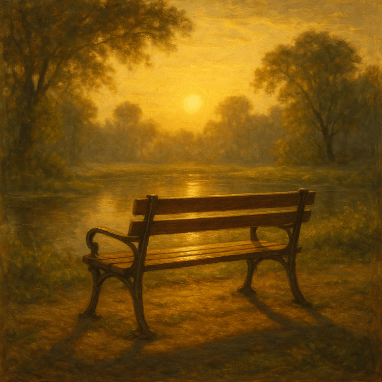
A park bench is never only wood and iron. It is a place where time itself seems to pause, a still point in the turning world. Simple, unadorned, and often overlooked, the bench waits with a patience that borders on eternity. Where lighthouses rise bold against the storm, park benches rest unnoticed in the shelter of trees and along meandering paths, offering not guidance to ships at sea but solace to souls at rest.
They are thrones without ceremony, open to all who approach. The hurried commuter catching a breath, the young lovers carving initials into its grain, the old man feeding sparrows, the child swinging feet too short to reach the ground—all sit with equal claim. In these ordinary moments, the bench becomes extraordinary, for it gathers the fragments of many lives and quietly binds them into a shared story.
At dawn, when the mist lingers low and dew glistens on the grass, benches hold the world in soft silence. They cradle the solitude of readers with coffee cups in hand, or the jogger pausing to stretch as the day stirs awake. By noon, benches come alive with voices—laughter, arguments, whispered secrets, and the chatter of children in play. At dusk, they return to meditation, their weathered slats bearing the weight of reflections too heavy to speak aloud.
But beyond the hours, beyond the seasons, there is something inherently romantic about a bench. It is a place where one may sit not only to rest but to wait. Lovers wait for each other on benches. Friends meet after years apart. A traveler, alone in a foreign city, may find on a bench both loneliness and comfort, the ache of absence and the hope of presence. A park bench is always waiting for someone—and in that waiting lies its poetry.
Benches, too, are shrines of memory. Some carry plaques with names: “In loving memory of…,” reminding us that a particular spot once belonged to someone’s favorite view, someone’s cherished hour. Even without engraving, the wood itself remembers. It remembers the kiss stolen under lamplight, the quarrel that ended in silence, the notebook filled with sketches, the tears that fell unnoticed while the world hurried past. A bench, in its stillness, absorbs more of human life than we imagine.
And yet, there is no pretense to its service. A bench does not ask to be admired. It does not strive to inspire awe. Its beauty is in its humility—steadfast, available, enduring. It offers nothing more than rest, and in that offering it becomes everything: a sanctuary, a stage, a confessional, a throne, a pew.
If lighthouses are monuments to survival, benches are monuments to presence. They remind us not how to endure storms, but how to pause in calm weather, how to savor the fleeting moments between motion. They are the poetry of ordinary time, the architecture of waiting, the geometry of intimacy.
So the next time you walk past a park bench, let it invite you. Sit. Rest. Allow the world to slow down. You may discover that the quietest structures—the ones we pass without notice—are the ones that most tenderly hold our lives.
Let the bench bear life’s storms so you can find peace.
This essay did not begin in isolation. It is the product of a long friendship and professional journey with my colleague and friend of 45 years, Dan Johnson. Dan is a retired city manager whose career I followed closely from start to finish. Though he often insists that I have been something of a mentor to him, being nearly eight years his senior, I have long considered him one of my most outstanding mentors.
Dan is unusually gifted: bright, articulate, persuasive, and approachable. He earned his undergraduate degree at a liberal arts school (Austin College) before completing a Master of Public Administration (UNT). Those experiences shaped his mind into a rare blend of philosophy and pragmatism. He thinks differently than most—able to reflect deeply on ideas while also commanding numbers, budgets, and analytics with clarity.
Dan & Lewis
This essay reflects the influence of his way of thinking. It was born from our conversations, his insights, and the questions he raises about how we remember the past. While I take responsibility for shaping and editing the writing, the heart of this piece owes so much to him. Dan is more than a co-writer in spirit—he is the spark that brought these ideas to life.
What follows, then, is not just an intellectual exploration. It is also a tribute to the kind of mentoring friendship that spans decades. Together we wrestled with how societies record events (history) and how they preserve meaning (heritage). Out of that dialogue came this essay, which I now offer with both gratitude and humility.
History: Chronos and the Record of Events
History lives in chronos, the measured unfolding of time. It examines cause and effect, documents and data, victories and failures. This approach often feels detached or clinical. A history textbook might describe the Great Depression in terms of unemployment rates and legislative acts, but not the emotions of the families who lived through it.
Yet this precision is valuable. By stripping away bias, history protects against myth and distortion. In the secular world, this means confronting injustices such as slavery, colonial exploitation, or political corruption. In the biblical world, this meant preserving accurate accounts of Israel’s rebellion as well as its faithfulness. As Ecclesiastes reminds us, “For everything there is a season, and a time for every matter under heaven” (Ecclesiastes 3:1). History shows us those seasons with clarity.
Heritage: Kairos and the Power of Memory
Heritage lives in kairos—the meaningful, sacred moments (the aha moment of the prodigal son) that transcend mere sequence. It is less about what happened and more about what still matters. Heritage is the story told at a family table, the song sung on a national holiday, the heirloom preserved with reverence.
For secular society, heritage might mean fireworks on Independence Day, memorial ceremonies at Ground Zero, or festivals that preserve immigrant traditions. These moments are powerful because they stir emotion—pride, grief, gratitude, belonging.
Scripture also emphasizes heritage. God commanded Israel to remember His works not only with words but with rituals and symbols. Joshua set up twelve stones by the Jordan so that when future generations asked, “What do those stones mean to you?” the story of God’s deliverance would be told (Joshua 4:6–7). In the church, Communion is heritage as well as history—“Do this in remembrance of me” (1 Corinthians 11:24).
Individual and Collective Memory
History often surveys nations and systems; heritage lives closer to home. For a historian, immigration may be a set of numbers. For a family, it is a recipe, a language, a story of survival. Both are true, but they speak differently.
Psalm 78 reminds us, “We will tell the next generation the praiseworthy deeds of the Lord.” Secular society echoes this impulse when it says, “Never forget” after national tragedy. Whether sacred or secular, heritage moves us beyond knowledge to identity.
Risks on Both Sides
Neither history nor heritage is sufficient on its own.
History without heritage risks being lifeless. Facts alone rarely inspire sacrifice or unity. A society that only analyzes but never remembers can grow cynical or rootless.
Heritage without history risks distortion. Pride and nostalgia can drift into myth, or worse, propaganda. Jesus warned against traditions that obscure truth (Matthew 15:6). In secular life, we see this when heritage clings to symbols without acknowledging the injustices tied to them.
Both truth and meaning are needed.
Chronos and Kairos Together
The ancient categories of time help explain this balance. Chronos is measured, sequential time—where history operates. Kairos is meaningful, appointed time—where heritage thrives. Secular societies and faith communities alike need both.
Chronos ensures we know what happened.
Kairos ensures we feel why it matters.
Germany’s reckoning with the Holocaust illustrates this balance. History preserved the sterile record—dates, numbers, documents. Heritage shaped memorials, ceremonies, and vows of “Never Again.” Without one, memory would be incomplete.
Bridging for Today
The healthiest societies, whether secular or religious, integrate both.
Education should combine historical facts with heritage storytelling, so students not only learn but also connect.
Memorials should preserve accurate history while also stirring reverence. A wall engraved with names is history; the silence of those who stand before it is heritage.
Families and churches should preserve both genealogies (history) and testimonies (heritage), ensuring truth and meaning pass together from generation to generation.
Reverence as the Key to Balance
Reverence is the posture that unites history and heritage. It is more than respect; it is a deep humility before the weight of memory. Reverence does not strip away facts, but it refuses to treat them as dry data. It does not idolize tradition, but it cherishes it with gratitude.
Reverence is what makes a classroom moment of silence powerful. It is what causes a museum visitor to lower their voice instinctively. It is what compels families to handle an heirloom carefully or churches to guard their sacraments with solemnity. Reverence bridges the gap between head and heart.
Without reverence, history becomes cold, reduced to statistics on a page. Without reverence, heritage becomes sentimentality or even manipulation. But when reverence surrounds both, truth gains depth, and memory gains integrity. Reverence allows us to honor both the accuracy of history and the meaning of heritage without confusing the two.
Case Study: Jericho as History and Heritage
Few places capture the interplay of history and heritage as vividly as Jericho.
History (Chronos) Archaeologically, Jericho is one of the oldest inhabited cities in the world. Excavations at Tell es-Sultan reveal settlement layers stretching back 10,000 years, including stone fortifications and one of the earliest known towers. Modern historians can date, map, and measure its ancient walls and subsequent occupations by empires ranging from Canaanite to Roman to Islamic. This is history in its most ordered form—facts, chronology, and evidence preserved across millennia.
Heritage (Kairos) For Jews and Christians, however, Jericho is more than stratigraphy. It is the city where God gave Israel victory, where walls fell not by human strength but by obedience and faith. That story is heritage—retold in sermons, children’s lessons, pilgrimages, and songs. In the New Testament, Jericho also becomes the setting where Zacchaeus climbed the sycamore tree to see Jesus, a moment that has been remembered not just as fact but as a symbol of personal transformation. Heritage makes Jericho alive with meaning long after the stones themselves have crumbled.
Reverence Reverence ties these together. Visitors lower their voices at Tell es-Sultan, not just because of history, but because of what the site represents. Pilgrims stand in awe before the sycamore tree or ride the cable car up to the Mount of Temptation. Reverence prevents history from being reduced to ruins, and it prevents heritage from slipping into sentimentality. It anchors both truth and memory in humility before something greater.
Governance and Culture Over Time Jericho also illustrates how governance and culture can change while heritage persists. Over its long history, Jericho has been ruled by Canaanite kings, Israelite tribes, Persians, Greeks, Romans, Byzantines, Muslim caliphates, Crusaders, Ottomans, the British, Jordanians, and now the Palestinian Authority. Its culture shifted accordingly—from Canaanite religion to Israelite worship, Byzantine Christianity, Islamic traditions, and today’s Palestinian Arab identity. Yet through all these changes, Jericho remained a living settlement, famed for its oasis agriculture and symbolic meaning. Its continuity as one of the world’s oldest inhabited cities shows how history records change while heritage preserves significance.
Jericho Today Modern Jericho is a Palestinian city of about 20,000 people in the West Bank. It is both an archaeological site of global importance—now UNESCO-listed—and a living community with markets, schools, and festivals. It stands as a meeting point of history’s chronos and heritage’s kairos, where the past is carefully studied and yet continually re-experienced.
Conclusion
“History vs. Heritage are two different things.” History is truth-seeking, analytical, rooted in chronos. Heritage is meaning-making, emotional, rooted in kairos. History without heritage becomes detached; heritage without history becomes distorted. Together, they give us memory that is accurate and alive.
For the Christian, this balance echoes God’s call to remember His mighty acts with both truth and love. For the secular world, it reflects the need to learn from facts while also cherishing identity. In both, the lesson is the same: we must carry forward the past with clarity of mind and depth of heart.


You must be logged in to post a comment.