The improbable, human, and slightly mad story of how television came to be
On a cold January afternoon in 1926, a handful of men crowded into a modest upstairs room at 22 Frith Street in Soho, London. The space smelled faintly of hot dust and ozone. Wires lay exposed. Motors whirred. A spinning metal disk clattered like a nervous clock.
At the center of this precarious contraption stood John Logie Baird—thin, intense, perpetually short of money, and absolutely convinced that the future was about to blink into existence.
Then it happened.
On a small screen—no larger than a postcard—a human face appeared, flickering, ghostly, undeniably alive. The man was not in the room. He was nearby, but separate. Yet there he was: eyes blinking, lips moving, a living person transmitted through space.
The witnesses understood instantly. They were watching the birth of television.
A device that shouldn’t have worked (but did)
Baird’s system was not elegant. It was mechanical, not electronic. At its heart was a Nipkow disk, a spinning metal plate punched with spiral holes that scanned an image line by line. Light passed through the disk, struck a photosensitive cell, and was converted into an electrical signal. Another spinning disk reassembled the image at the receiver.
The result was crude. Resolution was laughable. Brightness was terrible. Stability was optional.
But it worked.
The test subject that day—famously nicknamed “Stooky Bill,” a ventriloquist’s dummy used because living faces were hard to light—was soon replaced by real people. That mattered. Objects are clever. Faces are revolutionary.
This was the first public demonstration of television—not theory, not diagrams, not laboratory hints, but a working system shown to independent witnesses. January 26, 1926 is the line history draws in ink.
The man behind the madness
Baird himself was an unlikely prophet. Chronically ill. Financially unstable. Frequently dismissed as eccentric. He once tried to make diamonds from graphite in his kitchen and nearly poisoned himself experimenting with chemicals.
Yet he had vision in the literal sense. He wanted to send sight itself across distance.
And for a brief moment, he succeeded spectacularly.
By the late 1920s, Baird’s mechanical television could:
Transmit images over telephone lines
Broadcast experimental programs
Even produce crude color and 3D effects
He gave demonstrations to the BBC. He televised the Derby horse race. He beamed images across the Atlantic.
And then—almost as suddenly—his approach began to collapse under its own limits.
The quiet coup of electrons
While Baird wrestled with spinning disks and motors, others pursued a different path.
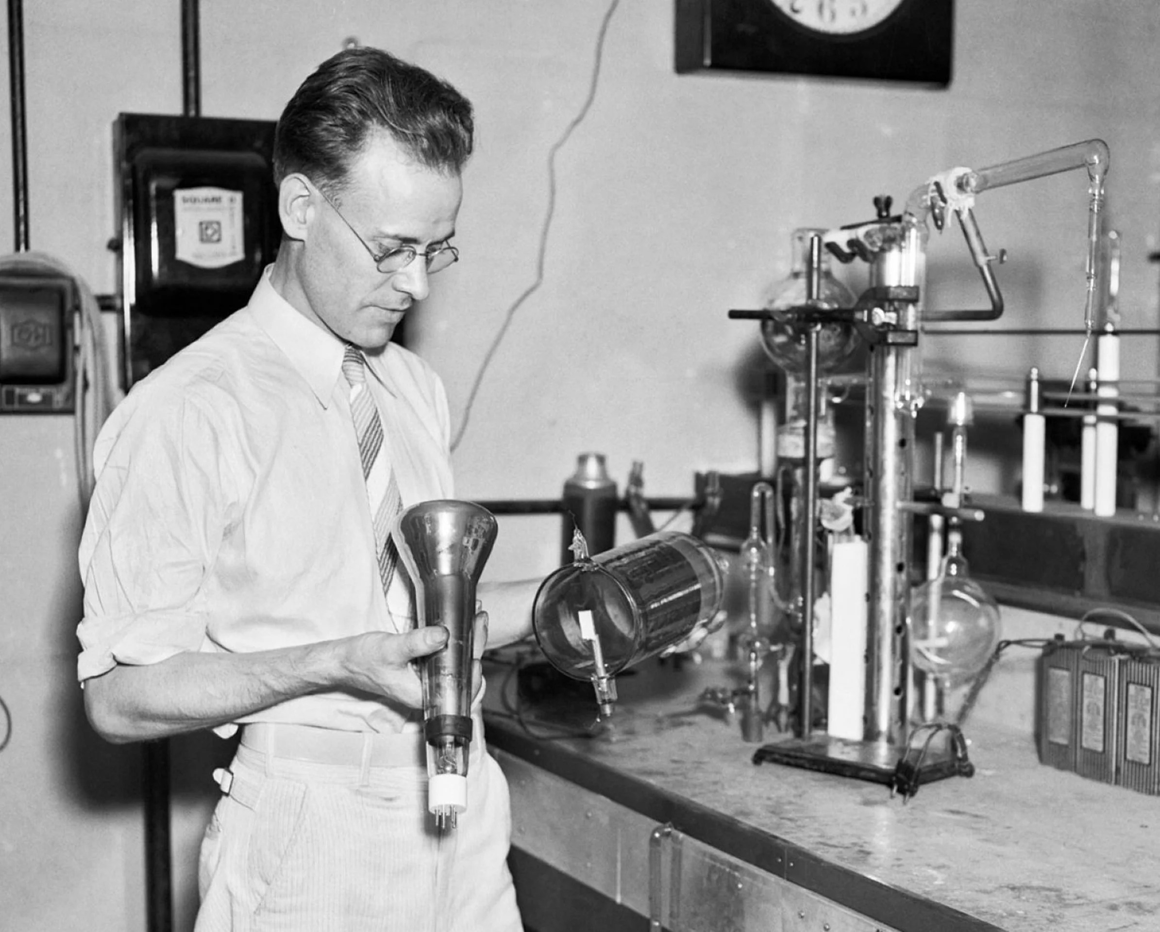
In America, a farm boy from Utah named Philo Farnsworth had a simpler, more dangerous idea: no moving parts at all.
Farnsworth envisioned scanning images electronically, using cathode rays controlled by magnetic fields. Faster. Sharper. Scalable.
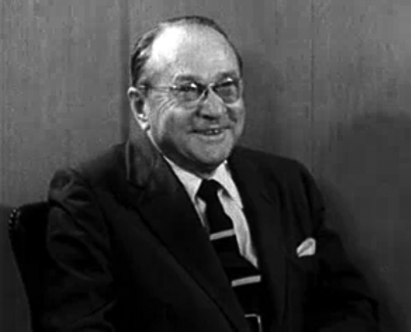
At RCA, Vladimir Zworykin pursued similar goals, backed by corporate muscle, lawyers, and laboratories that Baird could only dream of.
This was the real turning point in television history—not a technical tweak, but a philosophical shift:
Mechanical TV imitated the eye
Electronic TV outpaced it
By the early 1930s, the verdict was clear. Mechanical television had proven the concept—but electronic television would own the future.
Baird, tragically and heroically, kept experimenting. He never stopped inventing. But history moved on without him.
Television becomes a public force
In 1936, the BBC launched the world’s first regular high-definition television service from Alexandra Palace. Two systems were tested side by side: Baird’s mechanical approach and a fully electronic system.
The electronic system won.
Within a decade, television would:
Broadcast World War II aftermaths
Bring political leaders into living rooms
Turn moon landings into shared human experiences
Reshape advertising, culture, and power itself
What began as a flickering face in Soho became the dominant medium of the 20th century.
The deeper meaning of that flicker
Television didn’t just change entertainment. It changed how truth feels.
For the first time:
Distance collapsed into presence
Authority gained a face
Events became emotional before they became understood
Radio told you something happened. Television made you feel like you were there.
That power has been used brilliantly, irresponsibly, manipulatively, heroically—often all at once.
And it began not with polish or confidence, but with:
A fragile machine
A stubborn inventor
A moment when a human face appeared where none should have been
Epilogue: the man history almost forgot
John Logie Baird died in 1946, worn down, underfunded, and overshadowed by the electronic systems he helped make possible. Yet without him, television’s story would be incomplete.
He didn’t perfect the medium. He proved it could exist.
History is often like that. The ones who open the door don’t always get to live in the house.
But on January 26, 1926, the world crossed a boundary it can never uncross:
Skills, Motivation, and the Capabilities Behind Accurate Mapping
Introduction: The Human Attempt to Shrink the World Into Understanding
A map seems simple at first glance: a flat surface covered with lines, shapes, labels, and colors. Yet the act of creating an accurate map is one of the most difficult intellectual tasks humans have ever attempted. Mapping demands a rare combination of observation, mathematics, engineering, imagination, artistry, philosophy, and courage. It requires a person to look at a world too large to see all at once and to represent it faithfully on something small enough to hold in the hand. Every map, whether carved on a clay tablet or drawn by satellite algorithms, is a claim about what is real and what matters.
This paper explores the mapmaker’s mind across four eras—ancient, exploratory, philosophical, and modern technological—and then strengthens that understanding through case studies and technical appendices. Throughout the narrative, one idea remains constant: accuracy is not merely a technical achievement; it is a human triumph grounded in the mapmaker’s inner capabilities.
I. Ancient Mapmakers: Building Accuracy from Memory, Observation, and Survival
For thousands of years, before the invention of compasses, sextants, or even numerals as we know them, mapmakers relied on the most fundamental tools available to any human being: their memory, their senses, and their endurance.
A Babylonian cartographer might spend long days walking field boundaries and tying lengths of rope to stakes to re-establish property lines after floods. An Egyptian “rope stretcher” could look at the shadow of a pillar, note the angle, and derive a surprisingly accurate sense of latitude and season. Polynesian navigators sensed the shape of islands from the swell of the ocean, the direction of prevailing winds, the pattern of clouds, or the flight paths of birds—even when land was hundreds of miles away. All of this happened without written language in many places, and without anything like formal mathematics.
The motivations were simple but powerful. Survival required knowing where water, game, shelter, and danger lay. Governance required knowing how much farmland belonged to whom, where the temples held jurisdiction, and how to tax agricultural output. Trade required predictable knowledge of paths, distances, and safe passages. Human curiosity played its own role as well; people have always wanted to know the shape of their world.
Accuracy in ancient mapping was limited by natural constraints. Long distances could not be measured with confidence. Longitude remained elusive for nearly all of human history. Oral traditions, though rich, introduced distortions. Political agendas often shaped borders. And yet ancient maps show remarkable competence: logical river systems, consistent directions, recognizable landforms, and surprisingly stable proportionality. Accuracy was relative to the tools available, but the intent—the desire to record reality—was the same as today.
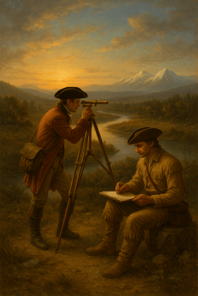
II. Explorers and Enlightenment Surveyors: Lewis & Clark and the Birth of Scientific Mapping
The early nineteenth century introduced a new kind of cartographer: the trained surveyor who combined field observation with scientific measurement. Lewis and Clark exemplify this transition.
Armed with sextants, compasses, chronometers, astronomical tables, and notebooks filled with surveying instructions, they attempted to impose geometric precision on a landscape no European-American had ever mapped. They measured solar angles to determine latitude, recorded compass bearings at virtually every bend of the Missouri River, estimated distances by managing travel speeds, and triangulated mountain peaks whenever weather permitted. Their notebooks reveal how meticulously they checked, recalculated, and corrected their own readings.
Their motivation blended national ambition, Enlightenment science, personal curiosity, and a desire for legacy. President Jefferson viewed the expedition as a grand experiment in empirical observation and hoped to gather geographic, botanical, zoological, and ethnographic knowledge all at once. Lewis and Clark themselves were deeply committed to documenting not only what they saw but how they measured it.
Despite their tools, they faced severe limitations. Cloud cover often prevented celestial readings. Magnetic variation made some compass bearings unreliable. River distances were difficult to estimate accurately when paddling against currents. Longitudes were usually approximations, sometimes guessed, because no portable timekeeping device of the period could maintain accuracy under field conditions. Yet the map produced from their expedition defined the American West for decades, confirmed mountain ranges, captured river systems, located tribal lands, and fundamentally reshaped the geographic understanding of a continent.
Their accomplishment demonstrates that accuracy is a function not only of tools but of discipline, repetition, cross-checking, and the mental fortitude to tolerate error until it can be corrected.
III. The Philosophical Mapmaker: Understanding That a Map Is a Model, Not the World
One of the most difficult but essential truths in cartography is that a map can never be fully accurate in every dimension. A map is a model, not the thing itself. Understanding this transforms how we judge accuracy.
No map can include everything. The mapmaker must decide what to include and what to omit, what to emphasize and what to generalize. This selective process shapes meaning as much as measurement does. A map that focuses on roads sacrifices terrain; a map that shows landforms hides political boundaries; a nautical chart prioritizes depth, hazards, and tides while ignoring nearly everything inland.
Even more fundamentally, the Earth is round and a map is flat. Flattening a sphere introduces distortions in shape, area, distance, or direction. No projection solves all problems at once. The Mercator projection preserves direction for navigation but distorts the sizes of continents dramatically. Equal-area projections preserve proportional land area but contort shapes. Conic projections work beautifully for mid-latitude regions like the United States but fail near the equator and poles.
Scale introduces another layer of philosophical choice. A map of a neighborhood can show driveways, footpaths, and fire hydrants; a map of a nation must erase tens of thousands of such details. At global scale, even major rivers become thin suggestions rather than features.
Finally, maps inevitably carry bias. National borders are often political statements as much as geographic descriptions. Cultural assumptions guide what is considered important. The purpose of a map—a subway map, a floodplain map, a highway atlas—governs its priorities. Every map quietly expresses a worldview.
Thus, “accurate” does not mean “perfectly true.” It means “fit for the purpose.” A map is correct to the extent that it serves the need it was created for.
IV. The Modern Cartographer: Satellites, GIS, and the Era of Precision
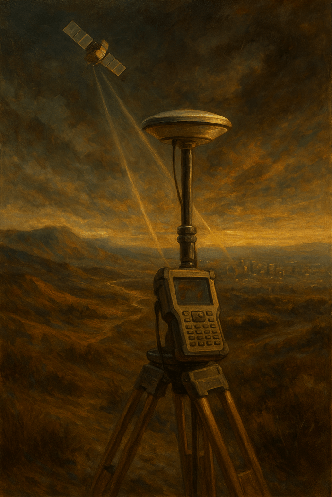
The modern mapmaker operates in a world overflowing with spatial information. GPS satellites circle the earth, constantly broadcasting timing signals that allow any handheld receiver to determine position within a few meters—and survey-grade receivers to reach centimeter-level accuracy. High-resolution satellite imagery captures coastlines, forests, highways, and rooftops with astonishing clarity. LiDAR sensors measure elevation by firing millions of laser pulses per second, creating three-dimensional models of terrain. GIS (Geographic Information Systems) software organizes, analyzes, and visualizes enormous spatial datasets.
The work of the modern cartographer is less about drawing lines and more about managing data. A GIS analyst must understand spatial statistics, database schemas, metadata verification, remote sensing interpretation, coordinate transformations, and the difference between nominal, ordinal, interval, and ratio data. The skill set is analytical, computational, and scientific.
The motivations have expanded as well. Modern mapping supports transportation engineering, zoning, emergency response, flood mitigation, environmental policy, epidemiology, commercial logistics, climate science, and international security. Governments, companies, and researchers all rely on constantly updated maps to make daily decisions.
Yet the abundance of data introduces new complications. Errors no longer stem primarily from lack of information but from inconsistency among datasets, outdated imagery, automated misclassification, incorrect coordinate transformation, or the false sense of precision that digital numbers can give. Even in a world of satellites, the mapmaker must remain vigilant and skeptical. Accuracy must still be earned, not assumed.
V. Case Studies: How Real Maps Achieve Real Accuracy
The theory of mapmaking becomes clearer when examined through specific examples. Four case studies reveal how different contexts produce different solutions to the same universal problem.
Case Study 1: The USGS Topographic Map
The United States Geological Survey began producing standardized topographic maps in the late nineteenth century, combining triangulation, plane-table surveying, and field verification. Later editions incorporated aerial photography and eventually satellite data. These maps formed the spatial backbone of national development. Engineers relied on them to place highways, dams, airports, pipelines, and railroads. Hikers and outdoor enthusiasts still use them today.
Their accuracy was remarkable for their time: often within a few meters horizontally and within a meter vertically. They became the nation’s common spatial language, demonstrating how consistent methodology and repeated verification create reliability across vast geographic space.
Case Study 2: Nautical Charts and the Challenge of the Ocean
No mapping discipline demands more caution than nautical charting. Mariners depend on accurate depths, hazard markings, and tidal information. Early sailors used weighted ropes and visual triangulation to estimate depth. Today’s hydrographers use multibeam sonar, satellite altimetry, LiDAR bathymetry, and tide-corrected measurements to produce charts that can reveal underwater features with astonishing detail.
Yet the ocean floor is dynamic. Storms move sandbars. Currents reshape channels. Dredging alters harbor depths. For this reason, nautical charts are never fully “finished.” They require constant updating. The challenge is not simply measuring depth once, but sustaining accuracy in a world that changes.
Case Study 3: The London Underground Map and the Meaning of “Accuracy”
The London Tube Map, introduced by Harry Beck in 1933, revolutionized the concept of cartographic truth. Beck realized that subway riders did not need geographic precision. They needed simplicity, clarity, and relational accuracy—knowing how stations connected, not how far apart they were in miles.
By replacing geographic realism with abstract geometry, he created a map that was technically inaccurate but functionally brilliant. Nearly all subway maps worldwide now follow the same principle. This case study illustrates that the “right” map is the map that serves the user’s need, not the map that most faithfully represents ground truth.
Case Study 4: Google Maps and the Algorithmic Cartographer
Google Maps represents an entirely new form of mapping. Unlike paper maps, it is not a static depiction of geography. It is a constantly shifting model created from satellite images, aerial photos, street-level observations, user reports, and complex routing algorithms. It recalculates itself continuously, adjusting for traffic, construction, business changes, and political variations in border representation.
Its power is extraordinary, but its limitations remind us that automation cannot eliminate human judgment. The platform reflects commercial incentives, political boundaries, and the imperfections of crowdsourced information. Accuracy is high but uneven, and like the ocean charts, the system must be updated constantly to remain trustworthy.
VI. A Unified Theory of Mapmaking
Across all eras and technologies, the mapmaker’s challenge remains the same. The world is too large and too complex to be perceived directly, so the mapmaker must choose which aspects of reality to capture. Those choices—shaped by purpose, tools, knowledge, and bias—determine whether the resulting map will be useful or misleading. Measurement introduces error; projection introduces distortion; interpretation introduces judgment. Accuracy is always relative to context, intention, and method.
The mapmaker succeeds not by eliminating error altogether, but by understanding its sources, managing its influence, and balancing the competing truths that every map must negotiate.
VII. Technical Appendices
Appendix A: Coordinate Systems and Projections
Modern mapping rests on systems that allow the entire Earth to be described mathematically. Latitude and longitude divide the globe into degrees, providing a universal reference easy to conceptualize but difficult to measure perfectly at large scales. The Universal Transverse Mercator (UTM) system divides the Earth into narrow vertical zones, each of which minimizes distortion for engineering purposes. The North American Datum (NAD83) and the World Geodetic System (WGS84) provide precise mathematical models of the Earth’s shape, enabling GPS receivers to calculate location with remarkable accuracy.
Map projections translate the curved surface of the Earth to a flat plane. Each projection sacrifices something: the Mercator preserves direction but exaggerates the size of high-latitude regions; equal-area projections maintain proportional land area at the cost of distorting continents; the Robinson projection compromises carefully to create a visually balanced world. The choice of projection reflects the map’s purpose more than the mapmaker’s preference.
Appendix B: Surveying Instruments Through Time
The tools of mapping have evolved dramatically. Ancient civilizations used gnomons to measure shadows, ropes to mark distances, and rudimentary cross-staffs to gauge angles. Renaissance innovations introduced compasses, astrolabes, sextants, and the plane table, bringing scientific precision to exploration. By the eighteenth century, the theodolite allowed surveyors to measure angles with unprecedented accuracy.
Modern surveyors rely on total stations, which combine angle measurement with laser-based distance calculation; GNSS receivers capable of centimeter-level precision; LiDAR instruments that generate three-dimensional point clouds of terrain; and drones that capture aerial photographs suitable for photogrammetric reconstruction. Although the instruments have changed, the underlying goal has remained constant: to measure the Earth in a way that minimizes error and maximizes reliability.
Appendix C: Sources of Error and How Mapmakers Correct Them
Cartographic errors emerge from several sources. Positional error occurs when instrument readings or GPS signals are distorted by environmental conditions, equipment limitations, or signal reflections from buildings or terrain. Projection error arises because any flat map must distort some combination of shape, area, direction, or distance. Human interpretation error appears during the classification of aerial images or the delineation of ambiguous features. Temporal error affects maps that have not been updated to reflect natural or man-made changes.
Mapmakers mitigate these errors by using redundant measurements, cross-checking data from multiple sources, incorporating ground-truth verification, applying statistical corrections, and selecting projections tailored to the region being mapped. Accuracy is achieved not through perfection but through a disciplined process of detecting, bounding, and correcting inevitable imperfections.
Conclusion: The Eternal Mind Behind the Map
From a Babylonian surveyor tying knots in a rope, to a Polynesian navigator reading waves in the dark, to Lewis and Clark marking compass bearings along unknown rivers, to a modern GIS analyst adjusting satellite layers on a computer screen, the mapmaker’s mind has never changed in its essential character. The world is too vast, varied, and dynamic to be seen directly, so we create representations—models that reveal structure, meaning, and relationship.
A map is not merely a depiction of space. It is a human judgment about what matters. Every accurate map represents a triumph of curiosity over ignorance, order over chaos, and understanding over confusion. The tools are part of the story, but the deeper story is the capability of the person wielding them: the patience to measure carefully, the discipline to verify and correct, the imagination to translate complexity into clarity, and the humility to know that no map is final, complete, or perfect.
Mapmaking is the oldest form of reasoning about the world, and perhaps the most enduring. To draw a map is to make the world legible. To understand a map is to understand the choices of the person who created it. And to appreciate accuracy is to recognize that behind every line lies a mind trying to grasp the infinite.
I. Introduction — The Spark That Changes the World
Every great invention begins not in a laboratory but in a restless mind that refuses to accept things as they are. The inventor lives in the thin air between wonder and frustration: the wonder of seeing what might be, and the frustration that it does not yet exist.
To invent is to cross the border between imagination and matter—between “why not?” and “now it works.” Across centuries, the world’s greatest inventors have built in different mediums—stone, steam, circuits, code—yet share the same mental wiring: curiosity that won’t rest, courage that won’t quit, and a faith that imagination can serve humanity.
II. The Inventive Mindset
The inventor’s mind is a paradox. It thrives on both chaos and order, fantasy and formula.
Curiosity is its compass—an ache to understand how things work and how they could work better.
Observation is its lens—seeing patterns others overlook.
Playfulness is its fuel—testing ideas without fear of failure.
Persistence is its backbone—enduring the thousand prototypes that don’t succeed.
Failure doesn’t frighten the inventor; indifference does. To stop asking “why” is a far greater tragedy than a circuit that burns or a model that breaks.
III. Ten Inventors, Ten Windows into the Mind of Creation
Leonardo da Vinci — Sketching the Sky Before It Existed
Leonardo filled his notebooks with wings, gears, and impossible dreams. He studied the curve of a bird’s feather as if decoding a sacred language.
“Once you have tasted flight,” he wrote, “you will forever walk the earth with your eyes turned skyward.” He painted with one hand and designed with the other, proving that art and engineering are not rivals but reflections. His flying machines never left the ground, yet every modern aircraft carries a trace of his ink.
Benjamin Franklin — Harnessing Heaven for Humanity
Franklin saw storms not as terrors but as teachers. He tied a key to a kite and coaxed lightning to reveal its secret kinship with electricity.
“Electric fire,” he marveled, “is of the same kind with that which is in the clouds.” The lightning rod followed—a humble spike that saved countless roofs. His bifocals, his stove, his civic inventions all arose from empathy: an elder’s eyes, a neighbor’s cold house, a printer’s smoky air. He turned curiosity into charity.
Eli Whitney — The Engineer Who Made Things Fit
Whitney watched field hands comb seeds from cotton and thought, There must be a better way. His wire-toothed drum and brush—the cotton gin—sped production a hundredfold.
“It was a small thing,” he later said, “but small things change empires.” The gin enriched the South and, tragically, deepened slavery. Seeking redemption through precision, Whitney built the first system of interchangeable parts, proving that uniformity could multiply freedom of production. He changed not just a crop but the logic of industry.
Thomas Edison — The Factory of Light
At Menlo Park, light spilled from the windows while others slept. Inside, hundreds of filaments burned and failed.
“I haven’t failed,” Edison smiled. “I’ve found ten thousand ways that won’t work.” When carbonized bamboo finally glowed for 1,200 hours, he built an entire electric ecosystem—power plants, wiring, meters, sockets. His true invention was not the bulb but the process of systematic innovation itself.
Nikola Tesla — The Dream That Outran Its Century
Tesla lived amid lightning of his own making. To him, the universe pulsed with invisible currents waiting to be tamed.
“The moment I imagine a device,” he claimed, “I can make it run in my mind.” His AC induction motor and polyphase system powered cities from Niagara Falls. His dream of wireless energy bankrupted him but electrified the future. In him, imagination was not daydreaming—it was blueprinting.
Marie Curie — The Glow of the Invisible
In a shed that smelled of acid and hope, Curie boiled tons of pitchblende until a speck of radium glowed.
“Nothing in life is to be feared,” she said, “it is only to be understood.” Her discovery of radioactivity opened new worlds of medicine and physics. During World War I she outfitted trucks with X-rays, saving thousands of soldiers. Science for her was not ambition—it was service illuminated.
The Wright Brothers — Learning the Language of Air
In their Dayton workshop, the Wrights balanced on wings of wood and faith. They built a wind tunnel, measured lift with bicycle parts, and studied every gust as if air itself were a textbook.
“The bird doesn’t just rise,” Wilbur observed, “it balances.” Their 1903 flight at Kitty Hawk lasted only seconds, yet the world’s horizon shifted forever. They proved that methodical curiosity could conquer gravity itself.
Albert Einstein — Thought as an Instrument
Einstein’s laboratory was his imagination. He pictured himself chasing a beam of light and realized time might bend to keep pace.
“Imagination,” he said, “is more important than knowledge.” From that image grew relativity, which remade physics. Yet his most practical insight—the photoelectric effect—became the foundation of solar power. Einstein invented with ideas instead of tools, showing that creativity can re-engineer reality.
Steve Jobs — The Art of Simplicity
Jobs demanded elegance as fiercely as others demanded speed. He fused hardware and software into harmony.
“It just works,” he’d say, though it took a thousand revisions to reach that ease. The Mac, the iPod, the iPhone—each was less a gadget than a philosophy: that design is love made visible. Jobs reinvented the personal device by stripping it down until only meaning remained.
Tim Berners-Lee — The Architect of the Digital Commons
In a corridor at CERN, Berners-Lee envisioned scientists everywhere linking their work with one simple syntax.
“I just wanted a way for people to share what they knew.” He built HTTP, HTML, and the first web server—then released them freely. No patents, no gatekeepers. His generosity made the World Wide Web the shared library of humankind.
Together they form a single conversation across centuries. Leonardo sketched the dream of flight; the Wrights gave it wings. Franklin tamed electricity; Tesla made it sing; Edison wired it into homes. Curie revealed invisible forces; Einstein explained them. Jobs and Berners-Lee re-channeled that same human spark into light made of code. Each voice answers the one before it, echoing: The world can be improved, and I will try.
IV. The Invisible Thread — Purpose and Pattern
Behind every experiment lies a conviction: that the universe is intelligible and worth improving. Their shared geometry is imagination → iteration → illumination. They teach that invention is not chaos but a form of hope—faith that our designs, however imperfect, can serve life itself. The true legacy of invention is not a patent portfolio; it is a pattern of thinking that turns wonder into welfare.
V. Conclusion — Love, Made Useful
The mind of an inventor is not born whole. It is forged in curiosity, hammered by failure, and tempered by empathy. These ten lives remind us that progress is a moral act, rooted in patience and compassion.
To think like an inventor is to love the world enough to fix it—to build not merely for profit or prestige but for people yet unborn. Invention, at its purest, is love that learned to use its hands.
Appendix — Biographical Notes and Key Inventions
Leonardo da Vinci — Italian polymath; foresaw helicopters, tanks, and canal locks through meticulous study of anatomy and motion. Key: flight sketches, helical air screw, gear systems.
Benjamin Franklin — Printer, scientist, diplomat; proved lightning’s electrical nature; invented lightning rod, bifocals, Franklin stove. Key: electrical experiments, civic innovations.
Eli Whitney — American engineer; built the cotton gin and standardized interchangeable parts for firearms, shaping mass production. Key: cotton gin, precision tooling.
Thomas Edison — Inventor-entrepreneur; created the practical light system, phonograph, and motion picture camera; pioneered industrial R&D. Key: incandescent lamp, phonograph, Kinetoscope.
Nikola Tesla — Serbian-American engineer; developed AC motors, polyphase power, radio principles, and the Tesla coil. Key: alternating-current system, wireless power concepts.
Marie Curie — Physicist-chemist; discovered radium and polonium; founded radiology; first double Nobel laureate. Key: radioactivity research, mobile X-rays.
Orville & Wilbur Wright — American aviation pioneers; invented three-axis control, conducted first powered flight. Key: controlled flight, wind-tunnel data.
Albert Einstein — Theoretical physicist; formulated relativity, explained photoelectric effect, father of modern physics. Key: relativity, photoelectric effect.
Steve Jobs — Apple co-founder; integrated technology and design into consumer art; drove personal computing and mobile revolutions. Key: Macintosh, iPod/iTunes, iPhone, iPad.
Tim Berners-Lee — British computer scientist; created the World Wide Web’s foundational architecture and kept it open. Key: URL, HTTP, HTML, first web server/browser.
🎨 Painting Concept: “The Council of Inventors”
Setting: A softly lit Renaissance-style hall that feels timeless — stone arches overhead, candlelight mingling with the faint glow of electricity. At the center, a great oak table curves like an infinity symbol, symbolizing endless human curiosity. Around it, the ten inventors gather in dialogue — not chronological, but thematic, their inventions subtly illuminating the room.
Foreground Figures
Leonardo da Vinci stands near the left, sketchbook open, gesturing midair with a quill as though explaining the curvature of wings. His gaze meets the Wright Brothers, who are bent over a small model glider resting on the table.
Benjamin Franklin leans in nearby, one hand on a metal key, the other holding a faintly glowing lightning rod that arcs softly — the light blending into the candle glow.
Across from him, Edison adjusts a glowing bulb, its light reflecting in Franklin’s spectacles. Behind him, Nikola Tesla gazes upward, a tiny arc of blue current jumping between his fingertips, illuminating the diagram behind them.
Middle Figures
Eli Whitney sits near the table’s midpoint, hands on precision tools and calipers, his musket parts laid out like a puzzle. The Wright Brothers’ propeller model rests beside his gear molds, symbolizing the bridge between ground and air.
Marie Curie stands slightly apart, her face serene but determined, holding a small vial that emits a gentle ethereal light — a faint halo of pale blue radiance, illuminating her lab notes.
Albert Einstein leans over her shoulder, pipe in hand, scribbling light equations on a parchment that glow faintly, as if chalked by photons.
Background Figures
Steve Jobs is seated farther right, dressed in his signature black turtleneck — timeless among them — explaining the first iPhone to Tim Berners-Lee, who nods thoughtfully while holding a glowing string of code shaped like a thread of light. Between them, a subtle digital aura rises — a lattice of glowing lines suggesting the web connecting every mind in the room.


You must be logged in to post a comment.